
SCAN TO BIM
Point cloud to BIM conversion with precise documentation of existing conditions
Architectural & Engineering Excellence
Strategic Value
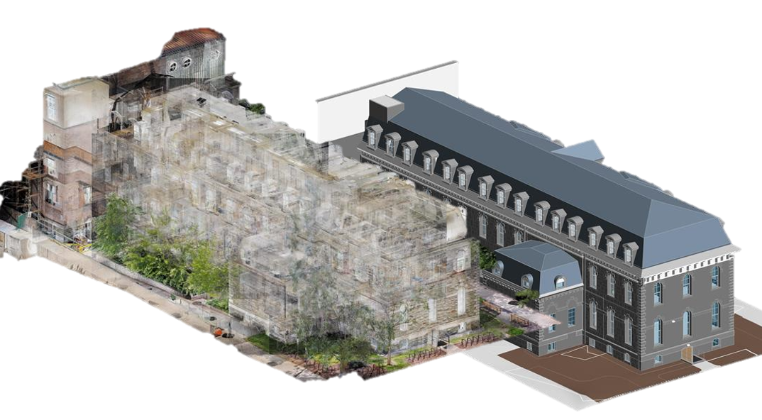
Our Scan to BIM services convert laser-scanned point cloud data into structured and accurate 3D BIM models. We use existing-condition scan data to develop architectural, structural, and MEP models that represent the physical condition of a building or facility. The modelling approach is tailored to the project scope, required LOD, point cloud quality, and client standards.
Technical Scope & Standards
We develop BIM models from laser scan and point cloud data for existing buildings, renovation projects, retrofit works, industrial facilities, and as-built documentation. Point cloud datasets are reviewed and used as the primary reference for modelling building elements and services. Our team can model walls, floors, ceilings, doors, windows, structural elements, equipment, ductwork, piping, cable trays, and other visible building components based on the available scan information. The resulting BIM model provides a structured digital representation of existing conditions that can support design development, coordination, renovation, and project documentation.
Core Service Deliverables
Point Cloud to BIM Conversion
Conversion of laser scan point cloud data into structured BIM models using the required modelling standards and project specifications.
Existing Building & Structural Modelling
Modelling of existing walls, floors, roofs, ceilings, openings, columns, beams, structural systems, and other identifiable building elements.
MEP & Equipment Modelling
Development of existing mechanical, electrical, plumbing, fire protection, piping, ductwork, cable trays, equipment, and visible services from scan data.
Point Cloud-Based Revit Modelling
Use of registered point clouds as a modelling reference within Revit to accurately interpret existing building geometry and conditions.
Renovation & Retrofit Support
Creation of existing-condition models that can be used as a reliable starting point for renovation, extension, retrofit, and new design development.
Existing vs Proposed Coordination
Comparison of proposed design information with existing scanned conditions to help identify spatial conflicts and installation constraints.
How We Deliver Value
Point Cloud Review & Quality Check
Review the supplied point cloud data, scan coverage, registration information, coordinate system, and project requirements.
Project & Coordinate Setup
Establish project units, levels, grids, coordinates, datums, and other modelling requirements based on the available survey and project information.
Point Cloud-Based Modelling
Develop architectural, structural, and MEP elements by interpreting the point cloud and modelling the required components at the agreed LOD.
Model Review & Verification
Review the developed model against the point cloud to check geometry, positioning, element representation, and modelling consistency.
Documentation & Coordination
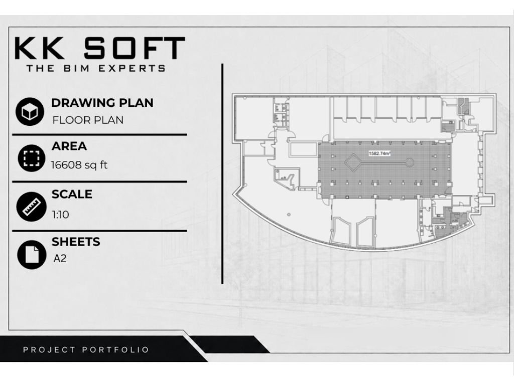
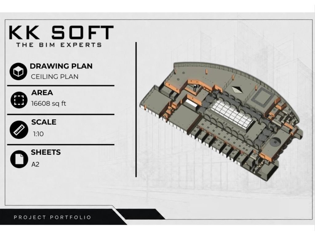
Generate required plans, sections, elevations, schedules, and other project documentation from the completed existing-condition model.
Final Model Delivery
Deliver the completed Revit model and other agreed project outputs according to the client's required format, standards, and project scope.
Demonstrations & Project Work
Quantifiable Project Benefits
Reliable Existing-Condition Information
Provides a structured digital representation of the existing building based on available site scan data.
Reduced Manual Measurement
Reduces dependence on repeated manual measurements when developing existing-condition documentation.
Better Retrofit Planning
Provides design teams with detailed information about existing spaces, structures, and services before new work begins.
Improved Design Coordination
Helps architects, engineers, and contractors understand existing spatial conditions and coordinate proposed systems accordingly.
Reduced Site Rework
Identifying existing conditions during the design stage can help reduce unexpected issues during construction and installation.
Have a Similar BIM Project?
Let's discuss how our SCAN TO BIM team can optimize your engineering workflow, reduce site rework, and guarantee project delivery.
DISCUSS YOUR PROJECT